UTM Geo Map (PREMIUM) 4.2.90 Apk for Android
updateUpdated
offline_boltVersion
4.2.90
phone_androidRequirements
5.0
categoryGenre
Apps, GPS
play_circleGoogle Play
The description of UTM Geo Map
Discover the Ultimate Free Application for Land Surveying and GIS!
Introducing a complete, simple, easy to use, and free application designed for Land Surveying, Topography, Bathymetry, and GIS. This versatile tool is perfect for professionals in Geodesy Engineering, Civil Engineering, Geology, and various other fields related to maps, coordinates, locations, addresses, and spatial analysis.
Key Features
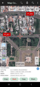
- Map Coordinates: Obtain real-time
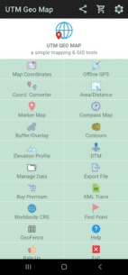
Latitude,Longitude,UTM,MGRS(WGS84), and other CRS using EPSG codes. Register points with coordinate data, time taken, notes, elevation (premium), addresses, and photos. - Offline GPS: Use your cellphone as a handheld GPS to acquire coordinates without internet access. Store unlimited coordinate data in your database, complete with notes and photos, or export to CSV, KML, DXF, and GPX formats.
- Coord. Converter: Convert coordinates manually between Latitude/Longitude and UTM/MGRS. Geocoding is also available for converting addresses to coordinates (requires internet).
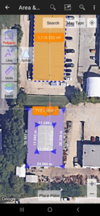
- Area/Distance Measurement: Measure distances and areas in various units (m, km, ft, miles, hectare, acre). Store line/polygon data and export to CSV, KML, or DXF formats.
- Marker Map: Perform complex geometry calculations and display dynamic buffers. Export geometries to KML or DXF files for use on other devices.
- Compass Map: Navigate easily with a map and compass featuring magnetic declination, measuring azimuth angles, distances, and directions.
- Buffer/Overlay Module: Execute buffering and overlay operations with options like Union, Intersection, and Symmetrical Difference.
- Elevation Profile: Create elevation profiles from height data with both metric and imperial units. Generate profiles from multiple points or routes (premium).
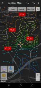
- Contours: Generate contour lines based on desired elevation or contour intervals. This premium module requires an internet connection.
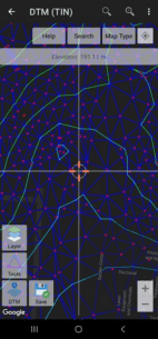
- DTM (Digital Terrain Model): Generate TIN/GRID surfaces and contour lines from elevation data, calculate cut-and-fill volumes, and refine TIN.
Additional Resources
For more information, visit our official website: utmgeomap.com
Access our quick guide in PDF format: Quick Guide (PDF)
Check out our YouTube channel for tutorials: YouTube Channel
Feedback and Suggestions
We welcome your suggestions! Please submit your feedback via email at [email protected] or write a review. Thank you!
What's news
This update includes stability improvements and bug fixes.
Download UTM Geo Map
Download the premium program installation file with a direct link - 10 megabytes
.apk


