ActiMap 1.8.1.4 Apk for Android

updateUpdated
offline_boltVersion
1.8.1.4
phone_androidRequirements
4.0.3
categoryGenre
Apps, GPS
play_circleGoogle Play
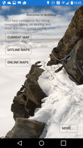
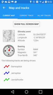
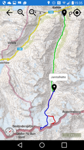
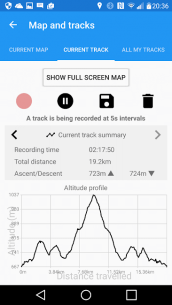
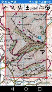
The description of ActiMap - Outdoor maps & GPS
Discover the 14-Day FREE Trial Edition of ActiMap
ActiMap is your ultimate companion for outdoor adventures! Designed specifically for GPS and navigation, it’s perfect for activities such as hiking, cycling, mountain biking, and ski touring. Whether you’re exploring the wilderness or just enjoying a leisurely day outdoors, ActiMap is here to guide you.
What's Included in the Starter Library?
ActiMap comes pre-installed with a small starter library of online maps, allowing you to navigate with ease. The library includes:
- OpenTopoMap: European topographic outdoor maps featuring contours and hillshading based on OpenStreetMap data.
- HikeBikeMap: Worldwide hike and bike maps based on OpenStreetMap data.
- OpenCycleMap: The OpenStreet cycle map.
- ArcGIS World Topo Map: Land cover and world topographic maps from various sources hosted by Esri.
National Topographic Maps
In addition to the starter library, ActiMap offers a selection of national topographic maps, including:
- Kompass: National topographic maps of Austria and Germany.
- Norwegian Mapping Authority: National topographic maps of Norway.
- UK Ordnance Survey: Landranger and Explorer type outdoor maps from Bing (*).
- IGN: Topographic maps of France from géoportail.
- USGS: Topographic maps of the USA at scales of 1:100000 and 1:24000.
Additional Features of ActiMap
ActiMap is packed with features to enhance your outdoor experience:
- Simple interface designed for on-the-go use.
- One-tap control for track recording.
- Real-time altitude profile of your current track.
- Add named waypoints to your current track.
- Real-time current location, heading, and track display.
- Compass with magnetic and true-North bearings.
- Mini-compass display on the map.
- Low battery usage for extended adventures.
- Download multiple maps simultaneously.
- Pause and resume map downloads effortlessly.
- Import, export, and share downloaded maps.
- Import, export, and share GPX files.
- Import and view Garmin Training Center (TCX) tracks.
- Manually add and edit map sources.
- Display multiple tracks and routes in different colors.
- Smooth map scrolling and zooming, not limited to fixed levels.
- Map scaling for easier reading of small fonts.
- Embedded help guide for offline use.
Note: The ActiMap user interface is currently available in English and German (BETA).
Important Licensing Information
When you purchase ActiMap, you are acquiring the functionality of the app, not a license to use the mapping data. The usage and licensing rights of the maps, as well as any downloaded GPX tracks, belong to their respective providers. Please honor these rights. All online maps in the starter library and the ActiMap online library are publicly accessible for free via their respective websites.
Note: Bing Maps, while publicly accessible at bing.com/maps, requires a key for access within an app such as ActiMap. The embedded ActiMap key is a basic limited-use key. Therefore, ongoing free access to Bing Maps is not guaranteed and will be reviewed based on usage.
Act Now!
Don't miss out on the opportunity to enhance your outdoor adventures. Get the Outdoor Map App You Need - ActiMap!
What's news
~ Fixed an issue whereby the app could sometimes crash when resuming after closing
Download ActiMap - Outdoor maps & GPS
Download the paid installation file of the program with a direct link - 20 MB
.apk


